
Tahoe research a major undertaking for computer mapping scientist Tim Minor
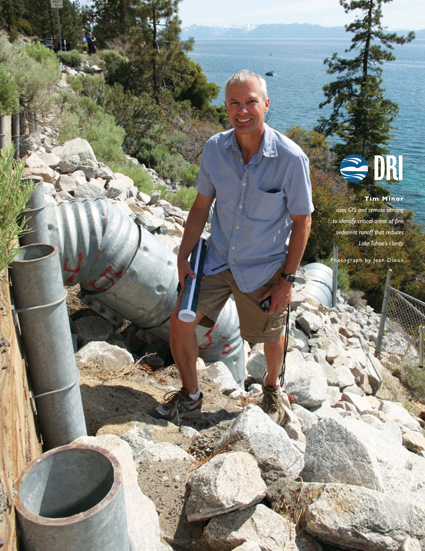
Tim Minor uses GIS and remote sensing to identify critical areas of fine sediment runoff that reduces Lake Tahoe’s clarity. Photograph by Jean Dixon.
Tim Minor, a computer mapping scientist at DRI, first encountered Lake Tahoe as an undergraduate at the University of Nevada, Reno, while attending a running camp in Homewood.
“I was astounded at how beautiful it was,” Minor said. “I thought myself pretty lucky to be running on these trails all around Lake Tahoe, just a beautiful place.”
Decades later, Minor returned to work at the lake with projects in mapping impervious surfaces and identifying the areas that runoff travels through and eventually enters the lake.
Minor’s work as a computer mapping scientist involves satellite and aerial photographs, which are both called remote sensing. These remotely sensed images can be used to convey different kinds of information for different purposes.
“I use computers and spatial data … for a particular science application or particular area,” he said.
Minor first started contributing to projects involving the Lake Tahoe Basin in the mid-1990s. But his first major project at Lake Tahoe began in 2002. Minor and fellow DRI remote sensing scientist Mary Cablk were commissioned by the Tahoe Regional Planning Agency (TRPA) to map the Tahoe Basin’s hard impervious cover—man-made surfaces such as concrete, metal or asphalt— that water cannot penetrate and prevents it from permeating into the soil.
“That was a multi-year project that was fairly ambitious because we pretty much tried to map every piece of hard impervious cover in the Basin, which included buildings, parking lots and roads,” Minor said. “Impervious cover is the stuff that water flows over and doesn’t sink into.”
Minor’s most recent ongoing project involves identifying sources of highway fine sediment in storm water and streams that eventually make it into the lake and affect its clarity. Minor uses geographic information systems (GIS) and remote sensing to identify critical point sources and areas. He is working on the project with fellow DRI scientists Jim Thomas, Alan Heyvaert, Ross Edwards and Markus Berli as well as John Reuter of the University of California, Davis.
“A lot of the fine sediments come off roadways into streams and those streams dump the particles into Lake Tahoe,” he said. “And that contributes to the decline in clarity.”
In addition to being a major contributor to such projects, Minor has taken on an advisory role with acquiring Light Detection and Ranging (LIDAR) data over the Tahoe basin, a “laser activated system that allows you to collect detailed information on the topography of an area.” The data can be used to assist in fire management by mapping vegetation and in hydrology studies through the creation of topographic models. Minor said the technology is of interest to the U.S. Forest Service, the TRPA, the California Department of Transportation, the U.S. Geological Survey and local fire districts in Lake Tahoe.
“There are a number of different federal and local agencies up in the Tahoe Basin that are trying to put this together,” he said. “Since that’s what I do as a remote sensing or computer mapping scientist, I’ve been consulting with them on some of the specifications.”
Though the former NASA scientist is mired deeply in his work at Lake Tahoe, he doesn’t lose sight of the bigger intentions of his work.
“(Lake Tahoe) is certainly a treasure for the local area,” Minor said. “And obviously I care quite a bit about the lake. I definitely feel quite
an attachment to it. I never get tired of just looking at it.”
